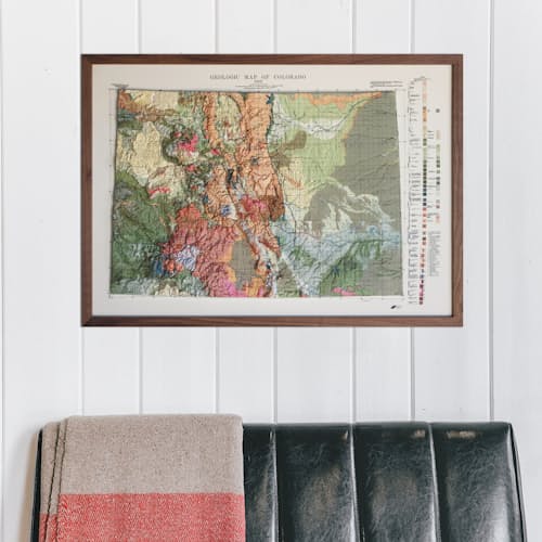
Meticulously printed, heated and vacuum-formed over an intricately detailed 3D mold, Muir Way’s 1913 topographical map of Colorado brings a one-of-a-kind tactile experience to the art of cartography. The 3D mold is cut with precision using NASA elevation data to create the most accurate and detailed map possible, so you can visually and tactically explore the state’s stunning mountainous terrain from the 14ers to the Black Canyon.
Features
3D design in a raised format for a truly unique tactile experience
Unframed 34”x 24” print
3D mold is precisely cut using NASA elevation data
Individually made in their San Diego shop
Materials
Plastic mounted on foam board
*You will love this map if you embrace its anomalies. When the plastic is heated and stretched over the 3D mold, the image may be altered, causing warped lines and text around higher elevations. The fine print on plastic is not as sharp as on paper, sometimes rendering very small text illegible.
Dimensions
34” x 24”
About Muir Way
As a die-hard National Parks explorer, Jared Prince saved the entrance maps of each place he visited—but they always ended up in some forgotten box. Determined to create maps meant for display, not back-of-the-closet hiding places, he started Muir Way. More than just art, his clean, colorful designs honor the places we love in stunningly accurate detail. Each one is meticulously crafted in San Diego, CA, and a portion of every sale supports organizations that preserve our land. For adventures you want to remember, and the ones yet to come, there’s probably a Muir Way map for that.