1
/
of
1
Muir Way
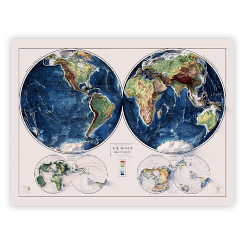
1917 World Relief Map
1917 World Relief Map
Regular price
$99.00 USD
Regular price
$99.00 USD
Sale price
$99.00 USD
Unit price
/
per
Story
A beautifully-rendered map of all the hills, peaks, mountains, and valleys in the world
If you ever wondered what Everest would look like from space or just how vast the Amazon river really is, just look to this map for some empirical evidence. With the exacting detail we’ve come to expect from Muir Way, this 1917 World Relief Map pulls data from digital elevation data (DED) compiled by the U.S. Geological Survey and then meticulously adds shading to render the planet’s topography in a beautiful full-color print. You’ll see something new every time you look at it thanks to the fine level of detail that the 2D format allows for—the perfect prize for the walls of anyone who’s always planning the next adventure.
Features
- Renders USGS data in a highly-detailed elevation map overlaid on a historical map of Earth from 1917
- Magnified terrain features and the application of shading work to exaggerate the appearance of each elevation
- 3D designs printed in a 2D format for a truly unique perspective
- Printed on archival, museum-quality paper using a 12-color giclée printer and archival inks that never fade
- Certified to last 100 years
- Unframed 24” x 32” print
- Printed in California
Materials
- 100% cotton, heavyweight 21.5 mil museum-quality paper
- Archival inks
- OBA-Free and Acid-Free
Sizing
- 24" H x 32" W